Local area predicted for flooding by end of week
Published 1:00 pm Wednesday, December 28, 2022
|
Getting your Trinity Audio player ready...
|
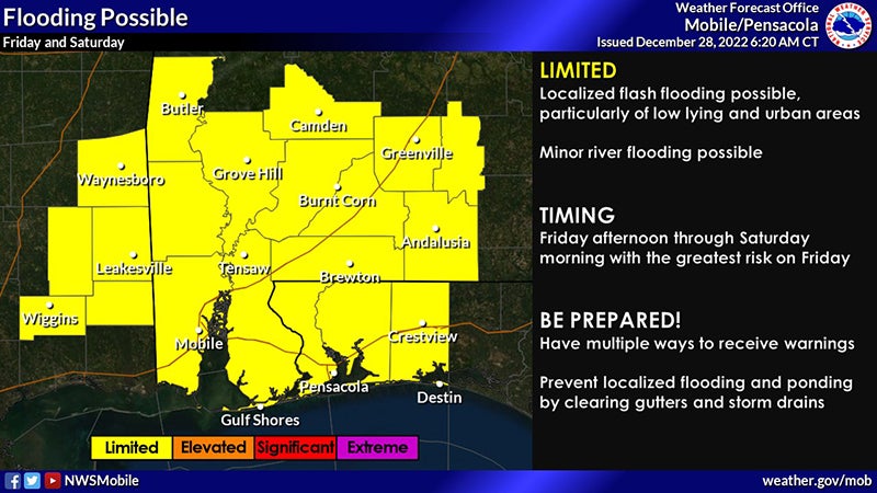
According to the National Weather Service, there is a possibility of local flooding forecast for the area Friday and Saturday.
The report stated that widespread showers and storms are expected to spread into the area on Friday and Saturday leading to the potential for flooding. There is a very low-end possibility for strong to severe storms on Friday and Saturday, but confidence remains low on this possibility. Persistent onshore flow will lead to sea fog, a high risk of rip currents, and building surf over the next few days.
Localized flash flooding is possible (particularly in low-lying and urban areas) due to multiple rounds of heavy rain. 2 to 3 inches of rain are expected with this event, but the possibility exists totals could rise. The timeline calls for Friday afternoon through Saturday morning with the greatest risk for flooding on Friday afternoon and evening. Although the entire area is at risk for flooding, the greatest risk is expected to remain south of Highway 84.
Along the coast, sea fog will be slow to develop Thursday night over the Mississippi Sound and Mobile Bay before spreading east into the coastal portions of the Florida panhandle throughout the day and evening on Friday (likely lingering into Saturday morning). Onshore flow will result in a high risk of rip currents for beaches in northwest Florida with a high risk for all area beaches Thursday through Saturday. Surf heights will quickly build to between 4 and 6 feet by Friday.
Another round of heavy rain and storms is possible heading into the middle of next week. Uncertainty remains concerning the potential for flooding and severe storms with next week’s event.
For more information contact the Covington County EMA office at 334-428-2670 or check the Covington County EMA’s Facebook page for additional updates regarding this week’s forecast.
More News


-
Polls
 Loading ...
-
-