NWS: Worst of rainfall happened Wednesday locally
Published 9:43 am Thursday, August 31, 2017
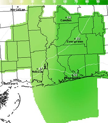
Meteorologists from the National Weather Service in Mobile are predicting that yesterday’s rain was the worst of what is to come.
They said there is more rain in the forecast, but it should decline each day throughout the weekend.
According to forecasts, approximately three inches of rain fell in the area Wednesday, Today they are predicting for there to be about an inch, and on Saturday about a half an inch.
The heavy part of the showers moved to the east early this morning.
Covington County is under a Flash Flood Watch until 6 p.m., today.
The rain has incresased water levels in local rivers, according to the Yellow Rivers Watershed Management website, but the local rivers are far below flood stages.
The water level for the Yellow River on Hwy. 55 and Hwy. 84, as both are sitting around 5 feet deep after the rainfall yesterday, according to the Choctawhatchee, Pea and Yellow Rivers Watershed Management website.
The Conecuh River at River Falls was sitting at 7.5 feet on Wednesday evening far from its 37 feet flood stage.
According to the gauges at Yellow River, there has been 1.60 inches of rain in the last three days at the Hwy. 55 station and 1.47 inches at the Hwy. 84 station.
More News


SportsPlus
How to Watch MLB Baseball on Friday, July 26: TV Channel, Live Streaming, Start Times
Today’s MLB slate has plenty of exciting matchups on the docket. Among those games is the Cleveland Guardians…
How to Watch the Braves vs. Mets Game: Streaming & TV Channel Info for July 26
Pete Alonso and the New York Mets will play Marcell Ozuna and the Atlanta Braves on Friday at…
Braves vs. Mets: Betting Preview for July 26
Francisco Lindor and the New York Mets (54-48) will host Marcell Ozuna and the Atlanta Braves (54-47) at…
Atlanta Falcons vs. Denver Broncos Week 11 Tickets Available – Sunday, November 17 at Empower Field at Mile High
On Sunday, November 17, 2024, the Atlanta Falcons (0-0) go head to head with the Denver Broncos (0-0)…
Atlanta Falcons vs. Seattle Seahawks Week 7 Tickets Available – Sunday, October 20 at Mercedes-Benz Stadium
On Sunday, October 20, 2024, the Seattle Seahawks (0-0) play the Atlanta Falcons (0-0) at Mercedes-Benz Stadium. Hoping…
-
Polls
 Loading ...
-
-