Severe weather expected for Thursday
Published 12:15 pm Wednesday, October 31, 2018
The Covington County Emergency Management Agency released this statement today:
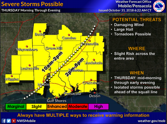
“Confidence is increasing that we will experience severe weather Thursday as satellite trends and data analysis show the system has continued to develop generally as the models have predicted. The entire area remains in a Slight Risk for Severe Thunderstorms on Thursday.
Yesterday’s projected timing of the main line of storms moving through the area between around 10 a.m., through 6 p.m., Thursday, still looks reasonable based on most of the guidance. However and unfortunately, there still remains some uncertainty with the timing as the system is still developing, and these times may be adjusted by several hours in future updates.
The possibility still remains that a few isolated severe thunderstorms could also develop out ahead of the squall line and these supercell thunderstorms would pose a higher risk for large hail and tornado development. Otherwise, the greatest risk will be for damaging wind gusts and perhaps a brief tornado or two along the squall line.
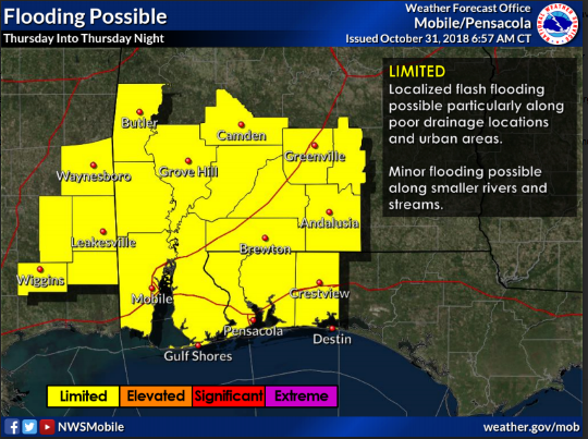
There still remains the potential of localized flooding, especially along poor drainage locations and urban areas as rainfall along the squall line may be intense at times producing as much as 1 to 3 inches of rainfall in a very brief time, with locally higher amounts. Significant rises and potentially minor flooding will also be possible along the smaller rivers and streams.
We’ll continue to monitor both the timing and intensity trends of the model guidance and notify you of any necessary adjustments to the forecast.”
More News


-
Polls
 Loading ...
-
-